
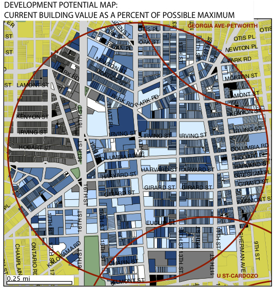
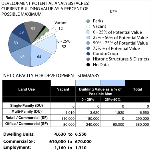
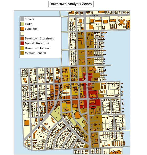
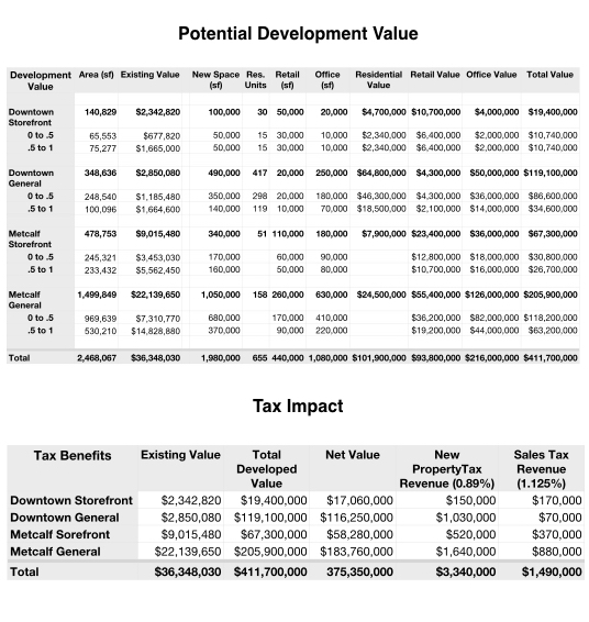
We analyze data from the client together with local market information to map potential sites for development. This exercise depends upon the availability of correlated data, but can determine land suitability for future development. This will identify vacant land ready for infill as well as underutilized parcels and buildings with potential for redevelopment. Coordinated with the design effort, this will quantify the capacity of the Study Area to support new housing, retail and employment space. As design scenarios are developed we can calculate and map themes relevant to the project including anticipated changes in assessed value for taxation, and expected changes in sales tax revenue. This can be a powerful economic development tool in targeting investment for sustainable development, designing land assembly strategies, and suggesting phasing and timing of actions.